British antiquarianism and the Levant
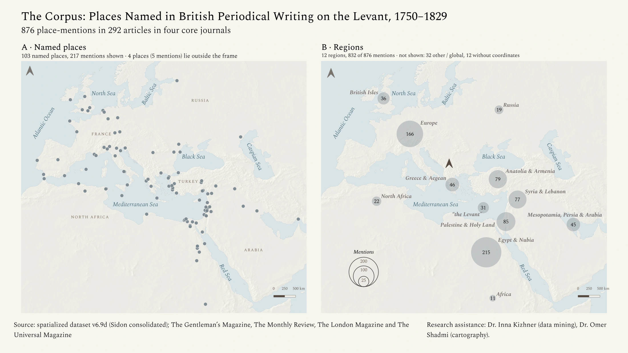
Methodology documentation forthcomingFound an error in this map? Let me know.
Cartographic work for a research project, accompanied by a place database and geographical visualization.
Selected cartographic work, followed by project collections and research in development.
Cartographic work for a research project, accompanied by a place database and geographical visualization.
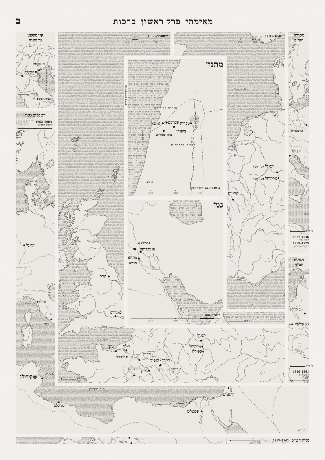
A cartographic composition bringing maps into the form of a scholarly page.
Maps for scholarly publications, dissertations, presentations, and other settings. The collection includes further examples in colour and greyscale.
An experimental atlas of one 50-square-kilometre area, examined through multiple thematic maps. Topography, Lithology & Hydrography, and Roads are available to browse.
Personal connections to places, shown through a map drawn from a scholar’s research.
Late Antique Mesopotamia with GIS: a developing spatial research resource drawing on several textual traditions.
Journeys to be presented through route maps and photographs.